


pointe de Tardevant

jfcontour
User

Length
14 km

Max alt
2478 m

Uphill gradient
1098 m
Km-Effort
29 km

Min alt
1441 m

Downhill gradient
1097 m
Boucle
Yes
Creation date :
2022-07-20 05:32:10.114
Updated on :
2022-07-20 13:36:12.99
7h02
Difficulty : Medium

FREE GPS app for hiking
 SityTrail
IGN / Geographical institutes
SityTrail Plus
The world is yours!
About
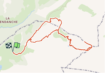
Trail Walking of 14 km to be discovered at Auvergne-Rhône-Alpes, Upper Savoy, La Clusaz. This trail is proposed by jfcontour.
Positioning
Country:
France
Region :
Auvergne-Rhône-Alpes
Department/Province :
Upper Savoy
Municipality :
La Clusaz
Location:
Unknown
Start:(Dec)
Start:(UTM)
304922 ; 5088513 (32T) N.
Comments